|
MEMBER MAP: A YEAR IN REVIEW - AND NEW FEATURES ADDED Written by Allen Roberts
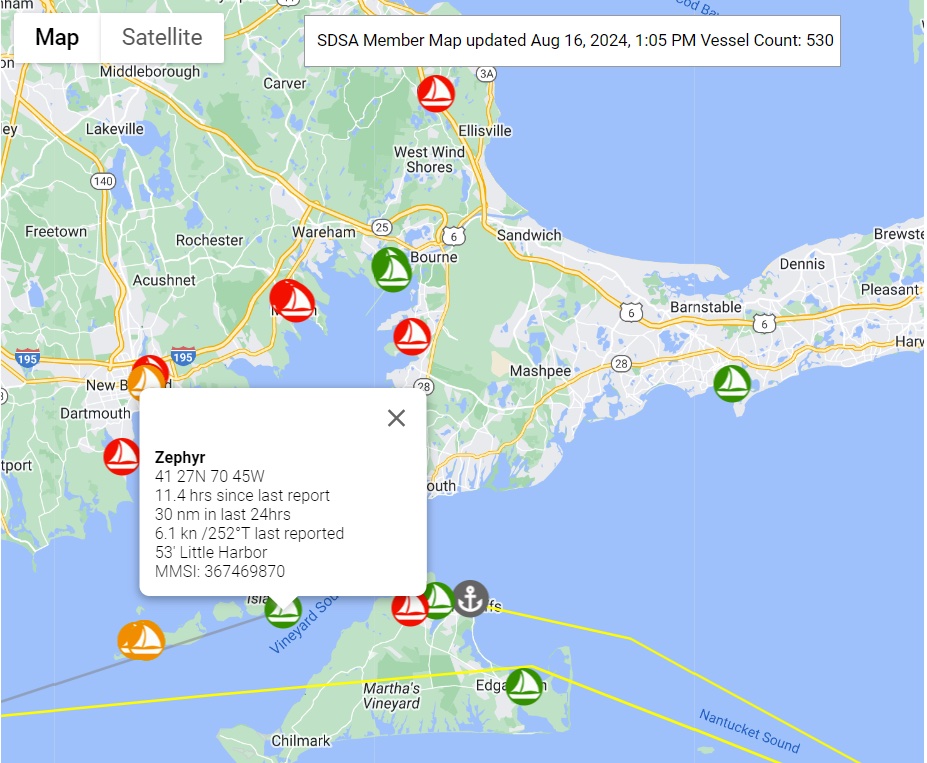
In the longest traveled distance category, the two top boats are SV Solano V with 15,010 nm and SV Crazy Horse with 11,939 nm. Solano V’s journey started in the Indian Ocean and they are now in Trinidad. Crazy Horse (who was in the 2023 Caribbean Rally), is now in Brisbane Australia. The two boats that have gone the furthest north are SV Rocinante, who visited Iceland this summer, and SV Rockhopper, who sailed in Norway. By the way, Mindy, aboard Rockhopper is our shoreside coordinator. The two furthest south boats are Solana V (who started their circumnavigation with the 2022 Caribbean Rally) and SV BioTrek, both rounding Cape Agulhas in Africa. The two boats that reported their current positions at the highest rate of all reporting boats were SV Rockhopper and SV Just Us. Finally, the longest nonstop passage was earned by SV Kailani with a distance of 5917 nm and SV Alruna with a distance of 4586 nm. Kailani and Alruna both started in Panama – Kalani (who was in the 2023 Caribbean Rally) went onto Tonga and Alruna onto Hawaii. Both very impressive voyages. As a reminder, the member map collects AIS positions for vessels up to five times a day–7AM ET, 10AM, 1PM, 4PM and 7PM. Because position reports are expensive, the SDSA maximizes coverage only for boats that are active. If a vessel hasn't transmitted a position in over a week, it is only sampled once a day. If a vessel has not transmitted in 48 hours, it is only checked every 12 hours. Therefore if a boat is not active, it could take up to 24 hours for its position to be updated once it becomes active. Active boats are highlighted in green (location changed in the last 24 hours) or in gray (has not moved in the last 24 hours). Boats are marked red if their position reports are more than 24 hours old or in orange if more than 12 hours. When you click on a boat, it will show the track of the boat between AIS updates. Keep in mind that those updates might be 12 hours (or more) apart, so the track will not represent the actual track of the vessel, just where it has been at each AIS sample point. Can’t find your boat on the map? Check the following:
The full FAQ for the map can be found at https://www.saltydawgsailing.org/member-map-faq?servId=10635. The member map is now integrated into the new SDSA App! The App version has even more features. You can now easily find nearby member vessels and also contact them by sending them a message directly from the map. The member map is located on the home page of the Salty Dawg App or on the SDSA website under Members (you must be logged in) at https://www.saltydawgsailing.org/member-map.
|

 A year ago, we launched our member map (
